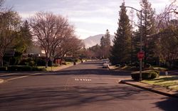
Walnut Creek, California
| City of Walnut Creek | |
|---|---|
| — City — | |
 |
|
 |
|
| Coordinates: | |
| Country | United States |
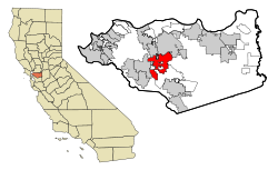
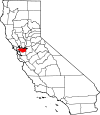
| State | California |
| County | Contra Costa |
| First settled | 1849[1] |
| Incorporated | October 21, 1914[1] |
| Government | |
| - Type | General Law[2] |
| - Mayor | Gary Skrel[3] |
| - Mayor pro tem | Susan Rainey[3] |
| - Councilmembers | Kish Rajan[3] Bob Simmons[3] Cindy Silva[3] |
| - State Leg. | Sen. Tom Torlakson (D) Asm. Joan Buchanan (D) |
| - U. S. Congress | John Garamendi (D) |
| Area | |
| - Total | 19.5 sq mi (50.5 km2) |
| - Land | 19.5 sq mi (50.5 km2) |
| - Water | 0.0 sq mi (0.0 km2) |
| Elevation | 131 ft (40 m) |
| Population (2000) | |
| - Total | 64,296 |
| - Density | 3,305.7/sq mi (1,276.2/km2) |
| Time zone | PST (UTC-8) |
| - Summer (DST) | PDT (UTC-7) |
| ZIP codes | 94595–94598 |
| Area code(s) | 925 |
| FIPS code | 06-83346 |
| GNIS feature ID | 1660120 |
| Website | walnut-creek.org |
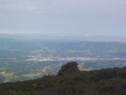
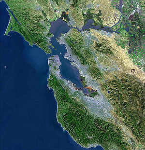
Walnut Creek is an incorporated city located 16 miles (26 km) east of the city of Oakland. It lies in the East Bay region of the San Francisco Bay Area. While not as large as neighboring Concord, Walnut Creek serves as the business and entertainment hub for the neighboring cities within central Contra Costa County, due in part to its location at the junction of the highways from Sacramento and San Jose (I-680) and San Francisco/Oakland (SR-24). The city had a total population of 65,384 as of January 2008 according to the California Department of Finance.
Contents |
History
There are three bands of Bay Miwok Indians associated with early Walnut Creek:[4][5] the Saclan, whose territory extended through the hills east of present day Oakland, Rossmoor, Lafayette, Moraga, and Walnut Creek; the Volvon (also spelled Bolbon, Wolwon, and Zuicun) at Mt. Diablo; and the Tactan at Danville and Walnut Creek, on San Ramon Creek.
Today's Walnut Creek is located amidst the earlier site of four Mexican land grants. One of these land grants – measuring 18,000 acres (73 km2) – belonged to Juana Sanchez de Pacheco, who deeded it to her two grandsons. Ygnacio Sibrian, one of the grandsons, created the first roofed home in the valley in about 1850. The grant was called Rancho Arroyo de Las Nueces y Bolbones, named after the principal waterway, Arroyo de las Nueces (Walnut Creek) as well as for the local group of indigenous Americans (Bolbones). The Arroyo de los Nueces was named for the occurrence in the valley of the native species of walnut tree, the California Walnut.
With the coming of American settlers following the US-Mexico War, a small settlement called "The Corners" emerged, named because it was the place where roads from Pacheco and Lafayette met. The site of this first American settlement is found today at the intersection of Mt. Diablo Boulevard and North Main Street. The first town settler was William Slusher, who built a dwelling on the bank of Walnut Creek, which was called "Nuts Creek" by the Americans in 1849. In the year 1855, Milo Hough of Lafayette built the hotel named "Walnut Creek House" in the corners. A blacksmith shop and a store soon joined the hotel, and a year later, Hiram Penniman (who built Shadelands Ranch) laid out the town site and realigned the Main Street of today. Two decades later, the community changed its name from The Corners to Walnut Creek.
In December 1862 a United States Post Office was established, and the community was named "Walnut Creek".[6] The downtown street patterns laid out in 1871-1872 by pioneer Homer Shuey on a portion of one of his family's large cattle ranches are still present today.
Walnut Creek began to grow with the arrival of Southern Pacific Railroad service in 1891. On October 21, 1914, the town and the surrounding area of 500 acres (2 km2), were incorporated as the 8th city in Contra Costa County.
A branch line of the Southern Pacific railroad ran through Walnut Creek until the late 1970s. The East Bay Regional Park District's Iron Horse Trail, used by walkers, runners and bikers, runs over what was portions of that branch line.[7] The mainline of the Sacramento Northern Railway passed through Walnut Creek. Both railroads had stations here. Today, the Pittsburg/Bay Point – SFO Line line of the Bay Area Rapid Transit (BART) serves Walnut Creek with a station adjacent to Highway 680.
With the opening of the Broadway Shopping Center, Contra Costa County's first major retail center, in 1951, the city took off in a new direction, and its population more than tripled from 2,460 in 1950 to 9,903 in 1960.
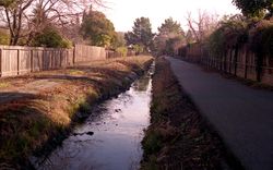
Today, Walnut Creek, the actual waterway, has been routed underneath downtown through a series of tunnels starting at the southwest end of Macy's and ending just southwest of Maria Maria Restaurant and bar.
Geography and climate
Walnut Creek is located at .[8] Portions lie in both the San Ramon Valley and the Ygnacio Valley below the western slopes of Mount Diablo.
According to the United States Census Bureau, the city has a total area of 51.6 km2 (19.9 mi²). 51.6 km2 (19.9 mi2) of it is land and 0.05% is water.
Climate
The area is characterized by a cool Mediterranean climate (Köppen climate classification Csb) with cool, moist winters and warm to hot dry summers. Average annual rainfall approximates 20 inches (510 mm), with slight variations occurring in microclimates based on elevation and topography. Winter daytime temperatures average in the mid 50s with little daily variation, while summer daytime temperatures average in the high 80s. 100 degree weather occurs numerous times during summer heatwaves, while occasional light frosts may occur during clear, calm winter nights. The climate allows for the successful cultivation of many plants and crops, being warm enough for citrus yet cold enough for apples. The Ruth Bancroft Garden is a renowned botanical garden that showcases the diversity of plants that can be successfully grown.
| Climate data for Walnut Creek, California (1893-2009) | |||||||||||||
|---|---|---|---|---|---|---|---|---|---|---|---|---|---|
| Month | Jan | Feb | Mar | Apr | May | Jun | Jul | Aug | Sep | Oct | Nov | Dec | Year |
| Average high °F (°C) | 54 (12.2) |
60 (15.6) |
64 (17.8) |
71 (21.7) |
78 (25.6) |
84 (28.9) |
87 (30.6) |
87 (30.6) |
83 (28.3) |
75 (23.9) |
63 (17.2) |
55 (12.8) |
72.4 (22.44) |
| Average low °F (°C) | 39 (3.9) |
42 (5.6) |
44 (6.7) |
46 (7.8) |
50 (10) |
54 (12.2) |
55 (12.8) |
55 (12.8) |
54 (12.2) |
49 (9.4) |
43 (6.1) |
39 (3.9) |
44.9 (7.17) |
| Precipitation inches (mm) | 4.25 (108) |
3.81 (96.8) |
3.24 (82.3) |
1.04 (26.4) |
0.46 (11.7) |
0.12 (3) |
0.02 (0.5) |
0.08 (2) |
0.24 (6.1) |
0.94 (23.9) |
2.59 (65.8) |
2.79 (70.9) |
19.58 (497.3) |
| Source: [9][10] | |||||||||||||
Open space
Walnut Creek owns more open space per capita than any other community in the state of California. In 1974, Walnut Creek voters approved a $6.7 million bond measure that allowed the city to purchase 1,800 acres (7 km2) of undeveloped hillsides, ridge lines, and park sites. Walnut Creek owns parts of Lime Ridge Open Space, Shell Ridge Open Space, Acalanes Ridge Open Space, and Sugarloaf Open Space.
The East Bay Regional Park District operates Diablo Foothills Regional Park, and Castle Rock Regional Recreation Area, in Walnut Creek.
Demographics
| Historical populations | |||
|---|---|---|---|
| Census | Pop. | %± | |
| 1870 | 250 |
|
|
| 1880 | 94 | −62.4% | |
| 1890 | 447 | 375.5% | |
| 1900 | 447 | 0% | |
| 1910 | 550 | 23.0% | |
| 1920 | 538 | −2.2% | |
| 1930 | 1,014 | 88.5% | |
| 1940 | 1,578 | 55.6% | |
| 1950 | 2,420 | 53.4% | |
| 1960 | 9,903 | 309.2% | |
| 1970 | 39,844 | 302.3% | |
| 1980 | 53,643 | 34.6% | |
| 1990 | 60,569 | 12.9% | |
| 2000 | 64,296 | 6.2% | |
| Est. 2007 | 63,286 | −1.6% | |
| source:[11][12] | |||
As of the census[13] of 2000, there were 64,296 people, 30,301 households, and 16,544 families residing in the city. The population density was 1,246.9/km2 (3,229.6/mi2). There were 31,425 housing units at an average density of 609.4/km2 (1,578.5/mi2). The racial makeup of the city was 83.89% White, 9.36% Asian American, 3.25% were multiracial. 1.96% from other races 1.07% African American, 0.33% Native American and 0.15% Pacific Islander. 5.99% of the population were Hispanic or Latino of any race.
There were 30,301 households out of which 20.9% had children under the age of 18 living with them, 45.7% were married couples living together, 6.7% had a female householder with no husband present, and 45.4% were non-families. 38.0% of all households were made up of individuals and 19.7% had someone living alone who was 65 years of age or older. The average household size was 2.09 and the average family size was 2.78.
In the city the population was spread out with 17.6% under the age of 18, 5.2% from 18 to 24, 27.1% from 25 to 44, 24.8% from 45 to 64, and 25.3% who were 65 years of age or older. The median age was 45 years. For every 100 females there were 85.8 males. For every 100 females age 18 and over, there were 81.5 males.
According to a 2008 United States Census Bureau estimate, the median income for a household in the city was $81,297, and the median income for a family was $113,996. The per capita income was $53,028. About 1.0% of families and 4.0% of the population were below the poverty line.[14]
Education
Public K-12
Walnut Creek residents attend schools in 5 public school districts.[15] The Walnut Creek School District (K-8) has 5 elementary schools and one middle school in the city. Some residents are served by schools from the Mount Diablo Unified School District (K-12), the Acalanes Union High School District (9-12), the San Ramon Valley Unified School District (K-12), and the Lafayette School District (K-8). The following public schools are within the city limits of Walnut Creek:
- Walnut Creek School District
- Buena Vista Elementary
- Eagle Peak Montessori (charter elementary)
- Indian Valley Elementary
- Murwood Elementary
- Parkmead Elementary
- Walnut Heights Elementary
- Walnut Creek Intermediate
- Acalanes Union High School District
- Las Lomas High School
- Acalanes Center for Independent Study (alternative program with a flexible schedule)
- Del Oro High (continuation school)
- Mount Diablo Unified School District
- Bancroft Elementary
- Valle Verde Elementary
- Walnut Acres Elementary
- Foothill Middle
- Northgate High School
Private K-12
Walnut Creek is home to several private K-12 schools, including
- Berean Christian High School (Grades: 9 – 12)
- Contra Costa Christian Schools (Grades: PK – 12)
- The Dorris-Eaton School (Grades: PK – 8)
- Garden Gate Montessori School (Grades: PK – K)
- North Creek Academy & Preschool (Grades: PK – 8)
- Palmer School (Grades: K – 8)
- St. Mary School (Grades: K – 8)
- Seven Hills School (Grades: PK – 8)
- Springfield Montessori School (Grades: PK – K)
- Walnut Creek Christian Academy (Grades: K – 8)
Public libraries
The Walnut Creek Library and the Ygnacio Valley Library of the Contra Costa County Library are located in Walnut Creek.[16][17] The Ygnacio Valley Branch, which opened in 1975, is also known as the Thurman G. Casey Memorial Library.[17]
On February 26, 2008, the city demolished the Walnut Creek Library, which was built in 1961 at the southern end of Civic Park. Mayor Gwen Regalia hosted a groundbreaking on the same site for the new library on May 19, 2008. The new library, designed by Group 4 Architecture, Research + Planning, Inc., has 42,000 square feet (3,900 m2) and an underground parking garage.[18] Construction was completed in 2010 and the library was officially opened on July 17, 2010.[19]
Fundraising and other support is provided by the Walnut Creek Library Foundation
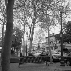
Culture
California Symphony
The California Symphony (notable for its commitment to the performance of music by American composers) has been based in Walnut Creek since its inception in 1986.
Center Repertory Company
The Center Repertory Company is the in-house theater company for the Lesher Center for the Arts. It stages six productions a year, including the annual production of A Christmas Carol.
Civic Arts Program
The city organizes education in graphic arts, sculpture, pottery, and performance arts such as dancing for various age groups is actively supported and encouraged by the Civic Arts Program.
Clay Arts Guild
Clay Arts Guild (CAG) is a non-profit volunteer organization supporting ceramics arts education under the Civic Arts Program of Walnut Creek. The organization is notable for its long history in the region (established in 1964) and the numerous sculptors and potters who have practiced, taught classes, and/or given masters seminars through its offices.
Activities supported by CAG include:
- Open studio monitoring for students enrolled in Civic Arts Classes
- Purchase of equipment for studio use
- Fundraising via direct sales of donated crafted goods and commission on sales of artist's goods
- Direct support of students through merit scholarships to Civic Arts Program classes
- Organization of master level seminars presented by innovative and famous artisans.
- All work produced using Civic Arts equipment can only be sold through CAG sales.
The Lesher Center for the Arts
Several performance spaces (The Knight Stage 3, The Hoffman, and The Margaret Lesher theatres) and the Bedford Gallery are included in this modern building. The Center is named for Dean Lesher, newspaper publisher and founder of the Contra Costa Times
Public transit
The city hosts two BART stations, the Walnut Creek station and the Pleasant Hill station (in the unincorporated area known as Contra Costa Centre Transit Village, just north of the city limits, named for the neighboring city). BART provides regional access in and out of Walnut Creek to most of the Bay Area.
A free shuttle operates between the central district and Walnut Creek BART station. Other areas of Walnut Creek may be accessed at modest cost by using the buses of the Central Contra Costa Transit Authority.
Walnut Creek is transected by the Iron Horse Trail (running north/south) through its downtown, as well as the Contra Costa Canal Trail (running east/west) at the north end of the city. Both these trails, in addition to the many bike lanes in the city make bicycle transportation very feasible for recreation or for an alternative commute.
Points of interest
- Castle Rock Park
- Heather Farm Park, including swimming at the Clarke Swim Center, tennis, picnic areas, community center, equestrian center, skate park, off-leash dog park, bike paths, playgrounds, sand volleyball court, fishing pond, nature pond, six athletic fields.
- Gardens at Heather Farm
- Mount Diablo
- Lesher Center for the Arts
- Ruth Bancroft Garden
- Shadelands Ranch Museum
- Old Borges Ranch, which is on the National Register of Historic Places
- Howe Homestead Park, 1920's era farm homestead, hosts the Howe Homestead Community garden and provides access to the Shell Ridge Open Space
- Boundary Oak Golf Course
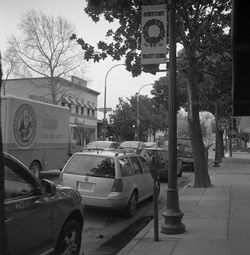
- Broadway Plaza shopping center
- Diablo Valley Lines (Walnut Creek Model Railroad Society)
- Lindsay Wildlife Museum
- The Carpenter Gothic chapel of St. Paul's Episcopal Church
- The San Francisco Creamery
Notable citizens
- Steve Alexakos, pro-football player
- Matt Anger, former tennis player
- Tom Candiotti, MLB player for the Milwaukee Brewers, Cleveland Indians, Toronto Blue Jays, Los Angeles Dodgers, and the Oakland Athletics.
- Richard Carlson, psychotherapist and famous writer of "Don't Sweat the Small Stuff" and 30 other motivational books[20]
- Sonja Christopher, Contestant on Survivor: Borneo
- Corey Duffel, professional skateboarder, was born in Walnut Creek, and still lives there.
- Kyle Gass, guitar player in Jack Black's band Tenacious D, grew up in Walnut Creek and attended Las Lomas High School.
- Lee Goldberg, television writer/producer (Diagnosis: Murder), A Nero Wolfe Mystery etc.) and novelist (the Monk novels, etc.) grew up in Walnut Creek, graduated from Northgate High School in 1980, and wrote for the Contra Costa Times.
- Alice Greczyn, actress, was born in Walnut Creek.
- Dan Haren, pitcher for the Arizona Diamondbacks, lives in Walnut Creek.[21]
- Marya Hornbacher U.S.A. Author
- Kristian Ipsen U.S diver
- Bessilyn Johnson, daughter of Hiram Penniman and resident of Scotty's Castle.
- Randy Johnson, professional baseball player, was born in Walnut Creek.
- Joshua Kors, award-winning investigative reporter, grew up in Walnut Creek, graduated from Las Lomas High School and wrote for the Contra Costa Times.
- Jenny Lynn, IFBB Professional figure competitor, and winner of the 2008 and 2007 Figure Olympia.
- Mark "Mad Dog" Madsen, professional basketball player for the NBA's Los Angeles Clippers, was born in Walnut Creek.
- John A. Nejedly (1914–2006), former state senator, lived in Walnut Creek for most of his life.
- Jason Newsted, former bassist for the heavy metal bands: Voivod, Metallica and Flotsam & Jetsam, lives in Walnut Creek.
- Markie Post, actress, grew up in Walnut Creek.
- Jeff Richards, writer and featured performer on NBC's Saturday Night Live, 2001-04.
- Lester Rodney, journalist who played a role in breaking down baseball's color barrier.
- Katharine Ross, actress, graduated from Las Lomas High School in Walnut Creek (1957).
- Justin Speier, Los Angeles Angels of Anaheim relief pitcher was born in Walnut Creek.
- Mike Mawhorter, actor and filmmaker, grew up and lives in Walnut Creek.
- Joe Starkey, California Golden Bears and former San Francisco 49ers Play by Play Announcer, lives in Walnut Creek
- Christy Turlington, model, was born in Walnut Creek.
- Terrence Wheatley American football player for the New England Patriots.
- Luke Whitehead, a basketball player for the Gold Coast Blaze.
- Bill Staley, NFL all pro, attended Las Lomas High School
- Rich Nye, MLB pitcher with three teams, attended Las Lomas High School.
- Ferris Fain, MLB all-star first baseman, resided in Walnut Creek.
In popular culture
- The 2009 Lifetime television movie Prayers for Bobby is based in Walnut Creek.
- The town is the setting of the 1954 Philip K. Dick short story "The Golden Man"
- In the PC video game Sim City 4, the California Plaza in Walnut Creek is one of the purchasable landmarks that can be placed in the game.
Further reading
- The Miwok - Mount Diablo's Earliest Inhabitants
- Mount Diablo Interpretive Association (MDIA) website
- Emanuels, George (1982). Ygnacio Valley, 1834-1970. ISBN 0-9607520-2-3. OCLC 9221187.
- Emanuels, George (1991) [1984]. Walnut Creek - Arroyo de Las Nueces. Walnut Creek, California, USA: Diablo Books. ISBN 0-9607520-2-1. OCLC 11704494.
- Nilda Rego (1998). Days Gone By in Contra Costa County Vol II. Lafayette, Calif: Great West Books. ISBN 1-889652-02-4. OCLC 71402468.
References
- ↑ 1.0 1.1 About Walnut Creek — History, walnut-creek.org, retrieved on 2007-10-08
- ↑ Rovanpera, Brad (2006). State of the City, 2005–2006. Walnut Creek, California: City of Walnut Creek. http://www.ci.walnut-creek.ca.us/pdf/State%20of%20City.2005-06.final.pdf.
- ↑ 3.0 3.1 3.2 3.3 3.4 Council Members, walnut-creek.org, retrieved on 2008-03-10
- ↑ Forester, 2006.
- ↑ Milliken, 1995
- ↑ Durham, David L. (1998). California's Geographic Names: A Gazetteer of Historic and Modern Names of the State. Quill Driver Books. p. 719. ISBN 9781884995149.
- ↑ About the Iron Horse Corridor. Retrieved May 28, 2010.
- ↑ U.S. Geological Survey Geographic Names Information System: Walnut Creek, California
- ↑ "Walnut Creek historic weather averages". Intellicast. http://www.intellicast.com/local/history.aspx?location=USCA1209. Retrieved 7 February 2010.
- ↑ Walnut Creek 2 ESE, California (049423) Climate Summary, Western Regional Climate Center. Accessed May 28, 2010.
- ↑ Moffatt, Riley. Population History of Western U.S. Cities & Towns, 1850-1990. Lanham: Scarecrow, 1996, 62.
- ↑ "Subcounty population estimates: California 2000-2007" (CSV). United States Census Bureau, Population Division. 2009-03-18. http://www.census.gov/popest/cities/files/SUB-EST2007-6.csv. Retrieved 2009-05-10.
- ↑ "American FactFinder". United States Census Bureau. http://factfinder.census.gov. Retrieved 2008-01-31.
- ↑ "Walnut Creek city, California Fact Sheet". 2006-2008 American Community Survey. U.S. Census Bureau. 2008. http://factfinder.census.gov/servlet/ACSSAFFFacts?_event=Search&geo_id=16000US0683332&_geoContext=01000US. Retrieved 2010-01-05.
- ↑ Walnut Creek City Council (2006-04-04). "Walnut Creek General Plan 2025". pp. 2–15. http://www.walnut-creek.org/citygov/depts/cd/planning/documents/general_plan_2025_(adopted_april_4_2006).asp. Retrieved 2010-02-23
- ↑ "Walnut Creek Library." Contra Costa County Library. Retrieved on April 1, 2010.
- ↑ 17.0 17.1 "Ygnacio Valley Library." Contra Costa County Library. Retrieved on April 1, 2010.
- ↑ City of Walnut Creek, Downtown Library Project, Construction on Track for New Library opening in 2010, retrieved July 26, 2010.
- ↑ Walnut Creek Library Foundation, New Walnut Creek Library Grand Opening, July 10, 2010.
- ↑ DelVecchio, Rick (2006-12-16). "RICHARD CARLSON: 1961-2006; 'Don't Sweat Small Stuff' author dies at 45". San Francisco Chronicle. article appeared on page B - 1 of the San Francisco Chronicle. http://www.sfgate.com/cgi-bin/article.cgi?f=/c/a/2006/12/16/BAGI9N0MOA1.DTL. Retrieved 2010-01-05.
- ↑ Suchon, Josh (2006-07-21). "Haren's home is in the East Bay". Oakland Tribune. http://www.findarticles.com/p/articles/mi_qn4176/is_20060721/ai_n16671517. Retrieved 2007-03-08.
External links
- City of Walnut Creek official web page
- Walnut Creek wikispot
- Walnut Creek Chamber of Commerce
- Walnut Creek travel guide from Wikitravel
- Transit Village Construction Virtual Tour
- Castle Rock Regional Recreation Area
- Diablo Foothills Regional Park
- Acalanes Union High School District
- Walnut Creek School District
- Mount Diablo Unified School District
- U.S. Geological Survey Geographic Names Information System: Walnut Creek, California
|
|||||||||||||||||||||||||
|
||||||||||||||||||||
 |
Martinez | Pleasant Hill • Concord | Clayton | |
| Lafayette | Mount Diablo | |||
| Moraga | Alamo • Danville |